|
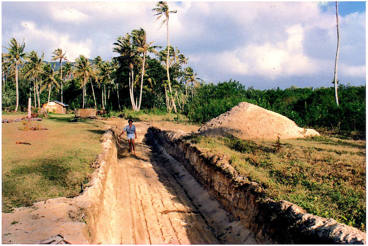
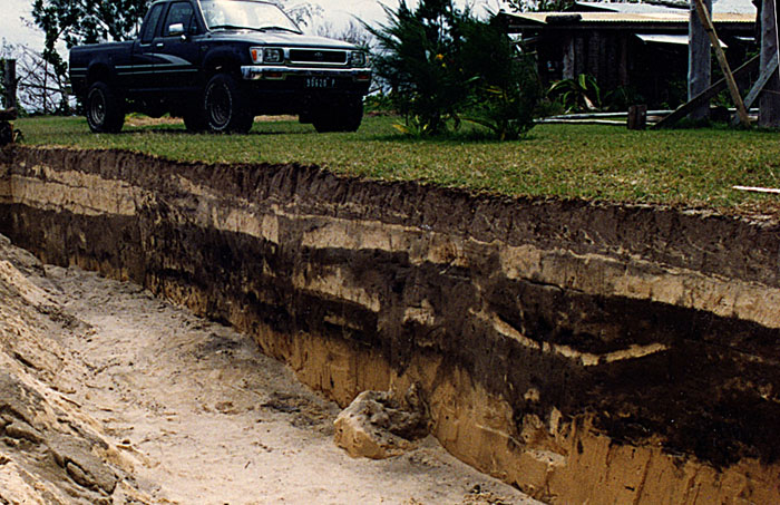
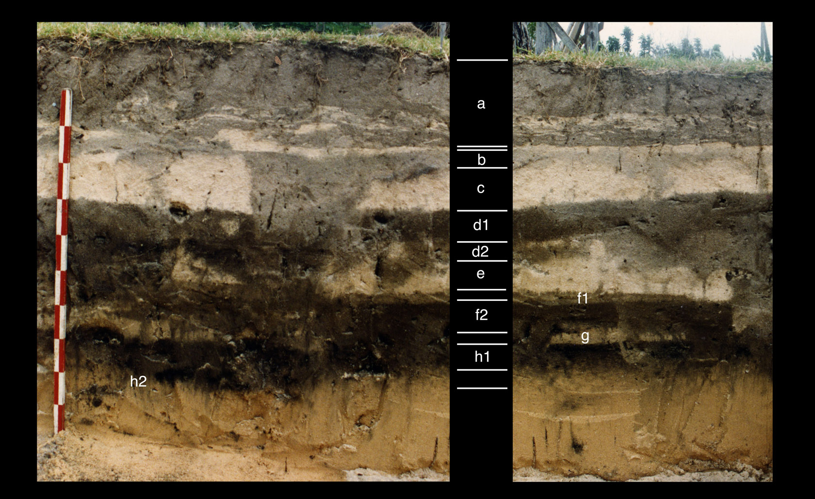
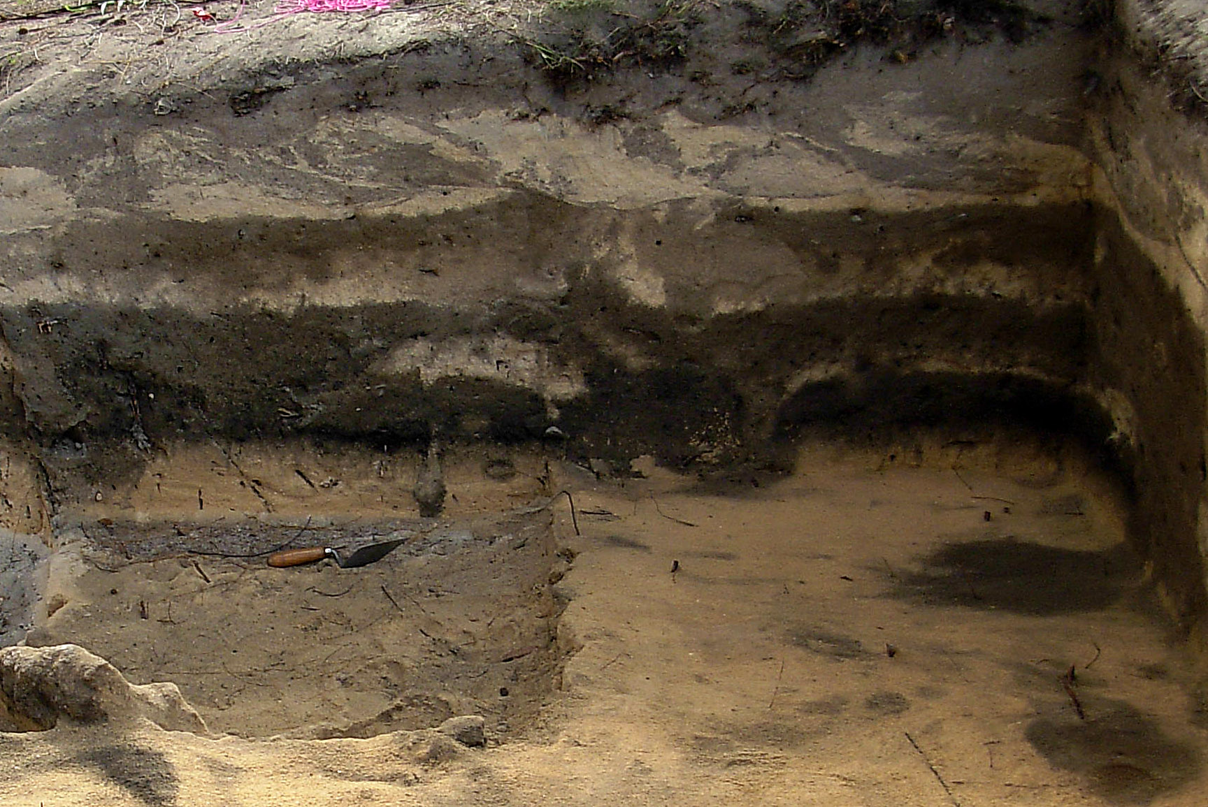
The story of the ATIAHARA trench started some years back when I told the wily old Gilbert Doom that there was a huge treasure buried under where he was planning to build his house, near the beach on a piece of land called ATIAHARA. I had been fossicking that land ever since it had been cleared for potato planting, and had found so many interesting artifacts there, including rare fishhooks, that I was now sorry to hear that Gilbert was going to build on the land. Actually I was kind of joking about buried treasure as I half imagined that he might think that it was the kind of treasure that pirates hide. Anyway, low and behold he stops me one day sometime in 1993 to say that he had found some treasure while digging a pit for his septic tank, I went to check his story and to my surprise he had found the very treasure that Mari Mari Kellum and I had been searching for, a year or two before (March-April 1991 see Volume 17), that is, deeply buried deposits, I assured Gilbert that this was indeed treasure. He showed me an interesting adze fragment, that he had recovered as well as bones and shell of all sorts. I told him that I would try to find a professional archaeologist to excavate the material correctly. I collected a good amount of material including charcoal, which I quickly shipped off to someone who I thought might be interested. However no one seemed keen and the ATIAHARA deposits fell into a kind of limbo, until May of 1994 when I had the good fortune of a chance meeting with Richard Shutler in Vancouver while I was on vacation there. I had taken some material including fishhooks to be photographed at the Simon Fraser University, these along with a couple recent Implementology volumes, sparked Professor Shutlers interest, and by the time I was due to return to Tubuai we had hashed out a plan for him to come down and investigate. This involved letters to The Department of Archaeology in Tahiti and for reasons which remain obscure, Dr. Shutler never received an official reply to any of his requests for permission to excavate in Tubuai. I myself wrote to and even met with the Minister of Culture to resolve the issue however the matter was still up in the air when in August of 1994, Gilbert Doom decided to dig an enormous hole in his back yard! Why would he do this? Dig an enormous trench with a back-hoe right through the precious deposits. He explained that he wanted to bury a lot of old tree stumps and cleared material and at the same time, make a sort of giant compost pit where he could later plant trees. I discovered Gilberts trench a few days after it had been excavated, it was 33 meters long 3 meters wide and a rather uniform 1.3 meters deep see the photo above! Here was an amazing spectacle, deeply buried and preserved deposits that were well below the plow zone and in some places over 1 meter thick. While I was examining the trench walls, I found some good charcoal samples that appeared to be from the lowest layer, and immediately sent them off to Professor Shutler who forwarded them on to Beta Analytic in Florida. |